Category:Hill, Gloucestershire
Jump to navigation
Jump to search
village and civil parish in Gloucestershire, UK | |||||
| Upload media | |||||
| Instance of | |||||
|---|---|---|---|---|---|
| Location | South Gloucestershire, Gloucestershire, South West England, England | ||||
 | |||||
English: Hill is a village in South Gloucestershire, England, midway between the towns of Thornbury in South Gloucestershire and Berkeley in Gloucestershire. The parish stretches from the banks of the River Severn to an outcrop of the Cotswold escarpment.
Subcategories
This category has only the following subcategory.
Media in category "Hill, Gloucestershire"
The following 103 files are in this category, out of 103 total.
-
 20th Century Ordnance Survey map of Hill, Gloucestershire.JPG 899 × 530; 116 KB
-
 20th Century Ordnance Survey Map of Hill, Gloucestershire.JPG 404 × 260; 30 KB
-
 A glimpse of Yew Tree Farm, Hill - geograph.org.uk - 1990734.jpg 640 × 480; 332 KB
-
 A junction of rhines - geograph.org.uk - 2709284.jpg 1,024 × 769; 259 KB
-
 A road junction on Nupdown Lane - geograph.org.uk - 2724169.jpg 800 × 600; 226 KB
-
 A small barn off Hill Lane - geograph.org.uk - 2724161.jpg 800 × 600; 245 KB
-
 Approaching Nupdown Farm - geograph.org.uk - 4324825.jpg 1,024 × 680; 263 KB
-
 Approaching zig-zag bend - geograph.org.uk - 2783305.jpg 1,024 × 636; 111 KB
-
 Bogged down on a monkey bike - geograph.org.uk - 3296223.jpg 640 × 480; 393 KB
-
 Brambles on the move - geograph.org.uk - 3295818.jpg 640 × 480; 530 KB
-
 Brick House Farm - geograph.org.uk - 2709302.jpg 1,024 × 769; 233 KB
-
 Bridleway across farmland - geograph.org.uk - 4331698.jpg 800 × 531; 146 KB
-
 Bus Shelter at Hill - geograph.org.uk - 2728694.jpg 675 × 1,024; 188 KB
-
 Cattle on a small escarpment - geograph.org.uk - 3296201.jpg 640 × 480; 394 KB
-
 Corner of Roundhouse Wood - geograph.org.uk - 3296390.jpg 640 × 480; 322 KB
-
 Court Farm, Woodend Lane, Hill, 1 - geograph.org.uk - 1990322.jpg 640 × 480; 365 KB
-
 Court Farm, Woodend Lane, Hill, 2 - geograph.org.uk - 1990326.jpg 640 × 480; 366 KB
-
 Entrance to Mazarine Farm - geograph.org.uk - 1990331.jpg 640 × 480; 322 KB
-
 Farmland around Upper Hill Farm - geograph.org.uk - 3172168.jpg 1,024 × 680; 265 KB
-
 Farmland in the Vale of Berkeley - geograph.org.uk - 4331085.jpg 1,024 × 680; 206 KB
-
 Field and cottage, Hill - geograph.org.uk - 1990738.jpg 640 × 480; 350 KB
-
 Field southeast of Cat Grove - geograph.org.uk - 3296405.jpg 640 × 480; 379 KB
-
 Fields above Upper Hill Farm - geograph.org.uk - 3296156.jpg 640 × 480; 313 KB
-
 Fields by Nupdown Farm - geograph.org.uk - 3062081.jpg 2,592 × 1,944; 1.8 MB
-
 Footbridge and stile near Hill - geograph.org.uk - 1990308.jpg 640 × 480; 436 KB
-
 Footbridge on the path to Hill - geograph.org.uk - 3295733.jpg 640 × 480; 537 KB
-
 Gateway to Hill Court, Hill - geograph.org.uk - 2368754.jpg 4,000 × 3,000; 2.78 MB
-
 Grit-bin, telegraph pole, postbox and road sign - geograph.org.uk - 2709319.jpg 1,024 × 769; 232 KB
-
 Hill Book Box - geograph.org.uk - 3175034.jpg 680 × 1,024; 207 KB
-
-
 Hill Pill - geograph.org.uk - 4325168.jpg 800 × 531; 93 KB
-
 Hill Pill - geograph.org.uk - 4331692.jpg 800 × 531; 141 KB
-
 Hill Pill - geograph.org.uk - 4331695.jpg 800 × 531; 148 KB
-
 Hill Pill at high tide - geograph.org.uk - 4325167.jpg 1,024 × 680; 290 KB
-
 Hill Pill joins the River Severn - geograph.org.uk - 2690095.jpg 769 × 1,024; 233 KB
-
 Hill Pill Sluice - geograph.org.uk - 4325170.jpg 800 × 531; 135 KB
-
 Hill village scene - geograph.org.uk - 314686.jpg 640 × 480; 69 KB
-
 House and orchard, Hill - geograph.org.uk - 1990316.jpg 640 × 480; 364 KB
-
 House and tree reflections - geograph.org.uk - 3175030.jpg 1,024 × 680; 299 KB
-
 House reflected in floodwater - geograph.org.uk - 3175028.jpg 1,024 × 680; 197 KB
-
 Knoll by Churchill Wood - geograph.org.uk - 1991044.jpg 640 × 480; 333 KB
-

-
 Lodge to Hill Court, Hill - geograph.org.uk - 1990746.jpg 640 × 480; 391 KB
-
 Lodge, Hill Court, Hill - geograph.org.uk - 2368749.jpg 4,000 × 3,000; 3.28 MB
-
 Looking down on Hill - geograph.org.uk - 3296119.jpg 640 × 480; 318 KB
-
 Looking east by Cat Grove - geograph.org.uk - 3296164.jpg 640 × 480; 471 KB
-
 Maniards Green - geograph.org.uk - 3174077.jpg 1,024 × 680; 199 KB
-
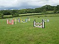
 Motocross course below Roundhouse Wood - geograph.org.uk - 1969089.jpg 640 × 480; 314 KB
-
 Motocross track near Newpark Farm - geograph.org.uk - 3296409.jpg 640 × 480; 370 KB
-
 No through road - geograph.org.uk - 3172172.jpg 1,024 × 680; 178 KB
-
 Nupdown Lane - geograph.org.uk - 2634786.jpg 800 × 600; 374 KB
-
 Oilseed Rape (Canola) - geograph.org.uk - 483676.jpg 640 × 480; 126 KB
-
 Old farm building near Upper Hill - geograph.org.uk - 3172176.jpg 1,024 × 680; 327 KB
-
 Old telephone box at Hill - geograph.org.uk - 2951082.jpg 1,024 × 768; 156 KB
-
 Ordnance Survey Cut Mark - geograph.org.uk - 4053380.jpg 480 × 640; 100 KB
-
 Prickly Restharrow, Ononis spinosa - geograph.org.uk - 3296213.jpg 640 × 480; 424 KB
-
 Ridge-and-furrow near Hill - geograph.org.uk - 1990304.jpg 640 × 480; 337 KB
-
 Ridge-and-furrow with thistles - geograph.org.uk - 1990090.jpg 640 × 480; 354 KB
-
 Road junction at Hill - geograph.org.uk - 3174083.jpg 1,024 × 680; 169 KB
-
 Road junction at Meadlands - geograph.org.uk - 3174079.jpg 1,024 × 680; 174 KB
-
 Road Junction by Hill - geograph.org.uk - 1217424.jpg 640 × 480; 55 KB
-
 Road scene at a place called Hill - geograph.org.uk - 2293637.jpg 640 × 480; 95 KB
-
 Road to Upper Hill Farm - geograph.org.uk - 3172170.jpg 1,024 × 680; 228 KB
-
 Running through long wet grass - geograph.org.uk - 3296172.jpg 640 × 480; 385 KB
-
 Scotlands Farm off Nupdown Lane - geograph.org.uk - 2724162.jpg 800 × 522; 249 KB
-
 Sheep above Upper Hill Farm - geograph.org.uk - 3296147.jpg 640 × 480; 406 KB
-
 Sluice gate for Hill Pill - geograph.org.uk - 2690089.jpg 1,024 × 769; 254 KB
-
 Small footbridge from Nupdown Lane - geograph.org.uk - 2634783.jpg 600 × 800; 381 KB
-
 South Gloucestershire , The River Severn - geograph.org.uk - 4623259.jpg 4,258 × 2,828; 6.98 MB
-
 South Gloucestershire , The Severn Bridge - geograph.org.uk - 4623260.jpg 4,258 × 2,828; 7.38 MB
-
 Southwest corner of Cat Grove - geograph.org.uk - 3296162.jpg 640 × 480; 468 KB
-
 Stone-built structure above Hill Pill - geograph.org.uk - 4326288.jpg 1,024 × 680; 351 KB
-
 Stream bed filled with mostly brambles - geograph.org.uk - 3295750.jpg 640 × 640; 734 KB
-
 Telephone box and cottages - geograph.org.uk - 3175043.jpg 1,024 × 680; 208 KB
-

-
 The Green, Hill, 1 - geograph.org.uk - 1990723.jpg 640 × 480; 315 KB
-
 The Green, Hill, 2 - geograph.org.uk - 1990752.jpg 640 × 480; 279 KB
-
 The lane to Upper Hill Farm - geograph.org.uk - 3009224.jpg 1,024 × 768; 206 KB
-
 The road to Manor Farm - geograph.org.uk - 2724181.jpg 800 × 600; 303 KB
-
 The Rockhampton turn, Hill - geograph.org.uk - 1990315.jpg 640 × 480; 293 KB
-
 The Severn Way approaching Hill Pill - geograph.org.uk - 4325164.jpg 800 × 531; 145 KB
-
 The way to St Michael Church, Hill - geograph.org.uk - 2724174.jpg 800 × 600; 331 KB
-
 The way to Upper Hill Farm - geograph.org.uk - 2724180.jpg 800 × 600; 256 KB
-
 Tidal levee on the banks of the Severn - geograph.org.uk - 4321828.jpg 800 × 531; 140 KB
-
 Top of a motocross track, Newpark Farm - geograph.org.uk - 3296401.jpg 640 × 480; 379 KB
-
 Tranton Lane - geograph.org.uk - 2951085.jpg 1,024 × 768; 150 KB
-
 Tranton Lane - geograph.org.uk - 3172179.jpg 1,024 × 680; 253 KB
-
 Tranton Lane - geograph.org.uk - 3175032.jpg 1,024 × 680; 252 KB
-
 Tranton Lane approaching Dayhouse Farm - geograph.org.uk - 3172180.jpg 1,024 × 680; 268 KB
-
 Tree by the rhine, Hill, near Thornbury - geograph.org.uk - 2293640.jpg 480 × 640; 138 KB
-
 Trees in water, Hill - geograph.org.uk - 3175027.jpg 1,024 × 680; 225 KB
-
 Up the hill to Hill church - geograph.org.uk - 2293777.jpg 640 × 407; 78 KB
-
 Upper Hill Farm - geograph.org.uk - 3296140.jpg 640 × 480; 345 KB
-
-
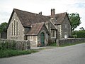 Village hall, Hill - geograph.org.uk - 1990729.jpg 640 × 480; 350 KB
-
 Village Hall, Hill - geograph.org.uk - 3175036.jpg 1,024 × 680; 198 KB
-
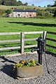 Water pump and cottages at Hill - geograph.org.uk - 3175035.jpg 680 × 1,024; 261 KB
-
 What sort of crop should we call this^ - geograph.org.uk - 3296135.jpg 640 × 480; 377 KB
-
 Woods and fields southeast of Hill - geograph.org.uk - 1990546.jpg 640 × 480; 322 KB
-
-
-
 Beyond Worldsend - geograph.org.uk - 483663.jpg 640 × 480; 91 KB
-
 Looking back to Worldsend Farm - geograph.org.uk - 483668.jpg 640 × 480; 88 KB


_-_geograph.org.uk_-_483676.jpg)


